In Progress!!
BEAUTIFUL hike through the narrows in an old mining area!! To get here, take 95 to Lake Mead and turn onto Lakeshore road. After passing the fee station, head to mile marker 10 where you will turn right onto Northshore road (you will see a sign to Overton here). Drive out to mile marker 16. At this marker there will be a turn off to the left, but there are no signs off Northshore Rd so be on the lookout! Once you turn on the road you will see a sign that says "Calville Wash." You used to be able to drive a couple miles out (if you had 4WD) to the trailhead, however the road has washed away. Right after you make the turn onto the unpaved road, go ahead and park; this is the new trailhead! The walk out to the narrows is pretty boring. I recommend bringing some good music to help.
Finding the trail was a little tricky for me. Sources I had read mentioned following tire tracks, but I quickly noticed there were tire tracks going many different directions. There were also a number of forks along the way that confused me. Luckily I had plugged coordinates into my GPS so that is how I determined which way to go. I'll try to describe the path here and use images to show what to look for! After you park, continue down the roadway. The day I went, there was a cone in the middle of the path blocking the road so cars can't pass. Go around this until you come to a mini drop-off (about 3ft). Diagonally to the right you will see a post (See picture below), that is where you want to go.
New Trailhead
 |
| Parking |
 |
| Parking |
 |
| From the parking, head around the corner shown |
 |
| Looking back at the cone blocking the roadway |
 |
| Looking back at the mini drop-off, if you can call it that! lol |
 |
| From the drop-off, looking diagonally to the right you will see a little mound of dirt and a post. This is the best way to head. When you get here, turn left and follow along the side of the dirt mound |
 |
| Another view of the mound and post |
 |
| Looking back at the mound that you go around |
 |
| After passing the mound, look for this area where the brown dirt becomes more grey and rocky. This is where the tire tracks begin that you will follow all the way to the Lovell Wash! |
 |
| Looking back at the grey/brown junction and the mound |
 |
| You will pass by this rock with the holes on the right |
Now there will be a serious of confusing forks in the trail, but don't worry! I'll guide you through them below. Although alternate routes are possible and you will see footprints every which way, I recommend staying on the main road with the big tire tracks. It just keeps things simple! Plus, I didn't see any advantage to taking the other routes.
 |
| Fork #1, stay left. You can go to the right, because this path will merge again with the one on the left shortly after the split, but it makes a longer curve and there is nothing interesting that direction to make it worth the extra walk! |
 |
| Here is a 3-pronged fork! Continue straight where it's labeled II. Alternately, you can take the trail marked I, but there are more forks that direction that may be confusing. Eventually it does meet up again with path II. "Merge" is where the trail to the right in the above picture meets back up with the main trail. |
 |
| This is where trail I and II meet back up in the picture above. When you are going back home, stay to the left at this fork to stay on the main trail. |
 |
| Another fork - follow the nail polish! hehe. I don't think the trail to the right goes anywhere... I didn't see a place where it meets back up with the main trail. |
 |
| Continue following the tire tracks until it drops down into a wash. Take a right here and follow the wash |

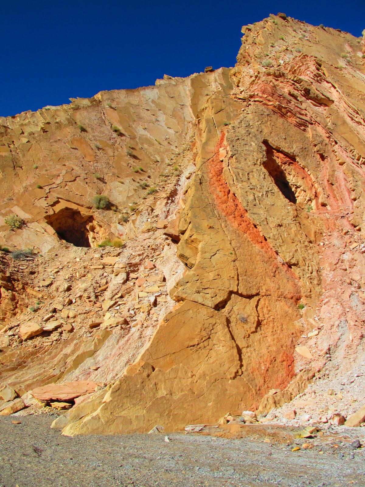
 |
| Old mine |
 |
| Collapsed mine |
 |
| When you see this on the left you're almost there! |
 |
| The wash leads straight into the narrows. From a distance, it doesn't look all that exciting! |


Wow - this is great! I'm headed to NV in June and was looking for hikes. Found this one and was starting to get confused by all the directions on various web pages. Your post is very helpful! Thanks!
ReplyDelete